Saturday, May 12, 2012

Twin Falls is a really nice city


Friday, May 11.

We headed out early this morning.We drove around the area to get a better feel for things.  I think we were the only people in entire 2,000+ acre BLM Milner Historic  Recreation Area.  This area has joined our Top Ten list.
We took the scenic US 30 route into Twin Falls rather then hoping in I-84. Before noon time we had filled up with propane, done the laundry, eaten apple fritters, dumped the tanks, topped off the water and finished our shopping at Fred Meyers.
Twin Falls has a free city dump station and water fill. It's right here: 42.55919 -114.47990.
After that we went to the Shoshone Falls. The local PR people call it the “Niagara of the West”. The falls are 212' high making them 50' higher then Niagara Falls. There is a nice paved trail through the area so the three of us were able to take a walk together.


Then we went to the Centennial Park which is at the bottom of Snake River canyon. The road going down to the park is a narrow, two lane road with a 10% grade, per the sign.
There is a very nice visitor center (42.59816 -114.45524) that accesses the Canyon Rim Trail System. It's right next to the Perrine Bridge that is 486' above the river. This bridge is a popular destination for BASE (Buildings, Antenna, Span, Earth) jumpers because such use is legal here and requires no permits. At any given time, twenty, or so, guys were hanging around getting ready to jump. Gopher and I watched a few of them. They land on the bank of the river about ½ mile from the bridge. 


There is a city RV park, Rock Creek Park, if you're so inclined. We're “camped”for the night in the Visitor Center parking lot watching the BASE jumpers and enjoying the Canyon Rim Trail. 


The Snake River Canyon


About a million years ago, a gigantic ancient lake called Lake Bonneville covered a large part of Northern Utah and parts of Southern Idaho and eastern Nevada; an estimated 20,000 square miles. Some 13,000 to 15,000 years ago the lake broke through south of Pocatello, ID to create one of the greatest floods known in the history of the world. The flood lasted for six weeks before the majority of the water had drained from the lake. In the above picture appears a light band of rock near the bridge supports. That was the level of the Snake River before the flood. The flood waters eroded away over 250'  of  the original river bottom.


On September 8, 1974, Evel Knievel made an unsuccessful attempt to jump the Snake River Canyon in Twin Falls. The site he used is on private property; not that we would have wasted the gas to see the memorial anyway.

Twin Falls also has all the big box and chain stores imaginable so most anything a person would need is here. Including a COSTCO.

Next time we're in the area, we'll come back.

Saturday:

Gopher and I were up early enough to see a group of BASE jumpers getting ready. We watched a handful of them jump.
About 8am we continued west along US 30 with no particular destination in mind. We came across the Hagerman Wildlife Management Area(WMA) and Idaho State Fish Hatchery which is just south of Hagerman. The hatchery raises trout and salmon to stock the rivers in Southern Idaho. In addition, they has a pubic viewing area with huge catfish, sturgeon, bass, and several other species. The WMA area has several lakes that are stocked and very popular with local families. Saturday morning especially.


 A sturgeon and a golden trout


An interesting Oregon Trail sign we came across.

At Barnes and Nobel in Twin Falls,I bought a Benchmark Road and Recreation Atlas for ID. I have these detailed maps for every state we plan on traveling extensively in. Just a little west of the hatchery, the map showed the Bell Rapids Sportsman’s Access(42.79299 -114.93674) so we decided to take a look. When we were in Northern Idaho in 2008, we discovered these access sites. As a general rule, free camping is permitted. Here the sign says there is a ten day camping limit. There are two tents pitched in a wooded area. This is where we'll be camping tonight. We're parked by the boat ramp watching the guys launching their boats for a days fishing. Most of the boats are the water powered jet boats.
A perfect place to spend a bright and sunny day. 

Tonights campsite      

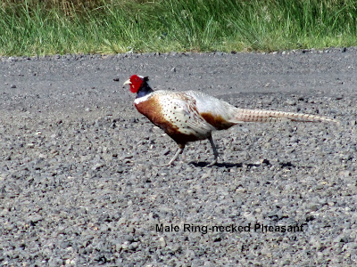
 He came strolling through the area. Bet he knows it's not hunting season!!

Thursday, May 10, 2012

A very blustery day


Gopher: If I was you, I'd think about skedaddlin' out of here.
Winnie the Pooh: Why?
Gopher: 'Cause it's "Winds-day."

We can remember reading that story to the children years ago.

The weather guessers say the winds are a steady 20 to 30 mph with gusts over 40mph.
The camper was really rockin' this morning so we moved to a more protected area. 
This is a very large BLM area. There are several designated camping areas plus disbursed camping.   We moved to more sheltered area where we could park facing into the wind. A big improvement. Our site: 42.53321 -113.97939 elevation 4,122' This site is large enough for three RV's and  even has a small wooden boat dock.  All this for $2.50/day.
This BLM area will go down as one of our favorites. 

The new computer is all setup.  I called AM Solar. The earliest they could get us in was June 6 so we'll be there.

In the morning, we'll continue west to Twin Falls for the weekend.


Our new camping area


More wagon train ruts.

Traveling the Snake River in an RV is a very pleasant journey. Here is a quote from the journal of Amelia Knight Stewart, 1853 Oregon emigrant.
"day traveling to day, no grass, water very scarce, stopt at noon to water at a very bad place on Snake river, 1 1/2 mile or more a steep bank or precipice the cattle looked like little dogs down there, and after all the trouble getting the poor things down there, they were so tired they could not drink and was obligated to travel back,and take the dusty road again, we are still traveling on in search of water, water"
Esther Belle Hanna, 1852. "This day is excessively hot, almost melting, and dust blinding, O for more patience to endure it all."


Once again, we seem to have the entire area to ourselves.

Wednesday, May 09, 2012

Some Idaho history and odds & ends

Idaho gets its southern border from England and Spain. To settle a territorial dispute they divided their interests in the west along the 42nd parallel in the Nootka Convention of 1790.  Everything above the 42nd parallel was English; everything below Spanish.  Today, the 42nd parallel is a border of Oregon, Idaho, California, Nevada and Utah. The northern border is the 49th parallel which is the U.S./Canada border agreed upon after the Louisiana Purchase of 1803. Idaho was originally part of the Oregon Territory which included the present states of Washington, Oregon and Idaho, along with parts of Montana and Wyoming.
The western border is based on the Snake, Owyhee, Clearwater  Rivers and straight lines formed by their juncture, along the117th meridian. When I was researching Nebraska, I discovered that Nebraska voluntarily gave up some land to Colorado to avoid having to deal with miners.  Interestingly enough, that's why both Oregon and Washington gladly gave up land to the east of their future states.. Following the discovery of gold around the Clearwater and Salmon Rivers, tens of thousands of miners flooded in. Governing these unruly people was of no interest to the politicians or Oregon or Washington. Seems miners had quite a reputation.
The eastern border is more complex. The center part follows the Continental Divide. The southern part is at 111*.  This was done to keep the neighbor to the east, Wyoming, at the preferred 7* width  like North and South Dakota,and Colorado.
The eastern border at the top of the state, the handle,  was the result of a very influential, and wealthy, judge and former Ohio congressman, Sidney Edgerton, who "arranged" to give a part of Idaho to Montana in return for who knows what!!  The rumor says the transaction cost $2,000 in gold coin. Today we call bribery, lobbying and its perfectly legal.

Idaho was admitted as the 43rd  state on July 3, 1890.

Two local guys about my age spent the day catfishing near us.  One of the guys worked for the local water district for over 30 years. The body of water we're camped on is know locally as the Milner Reservoir. It's formed by the Milner Dam impounding the Snake River for irrigation purposes. There are actually two dams; one belonging to one water control district and one owned by another. Each district is allowed to use a certain amount of water. The water is then allocated to farmers depending on how many shares of the water district they own. The general rule is that one acre of crop land gets 3/4 of a share. These shares can be bought and sold with the permission of the board-of-directors of the district. Generally speaking, one share sells in the range of $1,000 to $1,200. The number of shares owned has a huge influence on the value of land. No shares means no water and you get basically a patch of useless desert.

I spent most of the day getting the new laptop set up. Today was a perfect weather day.  Tomorrow the weather is supposed to get cold and very windy. Should have saved the computer stuff for tomorrow.


Our early morning walk & coffee.


Tuesday, May 08, 2012

North to Idaho.


Saturday, May 05, 2012
We left the Green River campground about 8:30am and drove to Vernal, UT for grocery shopping. The Smith’s grocery store has a very nice selection of prepared salads. Then the obligatory Wal-Mart stop. Continued west towards Duchesne(pronounced Do-Shay). It was very windy; the weather guy said the winds were from the WNW at 20-25mph gusting to 30mph. That doesn’t sound like a strong wind but, at times, it was coming from the side and I was constantly getting blown around so I decided to get off the road for the day.  That’s one of the things we like about our no-plans, no-reservations, no-commitments style of travel.  We simply do as we see fit.

Tonight we’re “camped” in the parking lot of the county rodeo grounds in Duchesne, UT. It’s a nice place right on the Duchesne River.  Our view one way is the river and the hills behind it; the other way is the city park and ball fields.  You’re supposed to keep dogs leashed but it’s only us so I let Gopher sit outside by herself. A fellow was walking his border collie and a basic mutt type dog, along the trail. The three of them had a nice game of chase for a while. The guy lives in town and kind of wondered why someone would actually want to visit here. I told him mostly we just drifted around and just happened to drift into Duchesne today. 


There are two gazebos next to where we’re parked. Cliff Swallows have built their very elaborate nests from bits of mud in the rafters of the gazebos. When ever we get close to the gazebo they take off.  We’re sitting inside watching perhaps, a dozen sallows zipping around. Now and then, a hawk flies over and the swallows disappear under the gazebo.

We changed our travel plan today. Not that we really had much of a plan to begin with. Instead of swinging south through California, Nevada and New Mexico, we decided to stay in Oregon, Washington, Idaho, Montana and  Wyoming then head south through Colorado on the way to the Balloon Fest in ABQ in October.
A group of camping friends are meeting up in the Gros Ventre area, near Jackson, WY, in August. We'll be joining them. 

It’s back to long pants. Yesterday, and again this morning, I was finally able to wear shorts and sandals for the first time on this trip. Tonight the weather guessers are talking about a low of 37*.  The forecast low at home for tonight is 68*.  Where would we rather be?? Not in F.P.  While checking the weather, I noticed the elevation in Fort Pierce is 14’. Right here it’s 7,311’.  For a couple of flatlanders, we’re about acclimated to the elevations differences.  We don’t huff and puff so much anymore.


Sunday
We awoke to 31*. I generally get up about 6:15, or so, and Gopher and I are sitting outside having our morning coffee by 6:30. (Water for Gopher). It’s just so peaceful early in the morning; that’s my favorite time of the day. The swallows and morning doves were  early risers as well.

About 8:30 we continued west to the Soldier Creek, USFS campground. Our campsite sits on a bluff with a panoramic view of the Soldier Creek Reservoir. The water level in the reservoir looks quite high to me.  Gopher and I took a nice walk, and a swim for her,  along the shore and saw muskrats, Western Grebes and American Coots. We’re not “birders” but do enjoy knowing what we’re looking at.  There are signs cautioning you to watch out for the badger holes.  The shoreline was littered with fisherman type trash. Empty bait containers, mono-filament line, cigarette packs, bottles and cans, on and on.  Why folks do that escapes me. I’ll bet their house looks about the same.


Don and Dorothy Malpas pulled in this afternoon. We always enjoy company; Lazy Daze company in particular.

Tomorrow we continue on

Monday:

This mornings 6:30 coffee, and Gophers walk, saw us at 28*; the coldest day so far on this trip.  We headed out about 8:30 with a general destination of the Pineview Reservoir near Huntsville, UT.  We try to limit a days driving to two hours and Huntsville was one hour and 45 minutes away.  We’re camped at the Anderson Cove USFS campground. The campground just opened last Friday. In fact, when I called to inquire last week, I was told the campground wasn’t opened. Our initial plan was to find a disbursed camping site in the area. I stopped at the local USFS office to inquire and was told there was no disbursed camping on the reservoir but Anderson Cove had just opened.  It’s us and two other campers. Come Memorial Day, that will come to a screeching halt. We have a super site right on the shore of the reservoir. Took Gopher for a nice swim. $11/night. The campground has a dump and water fill station. 


We’re still kicking around ideas for next year.  We’ll likely head home after the Balloon Fest, take care of business, doctors, and such, then head out West again.  Carol has to get with her doctor every six months or so.
 
Tuesday. Spuds & Ruts

 We went into Ogden to stock up on groceries before heading to our next camping area in Idaho. My six year old laptop has been acting up so I went to Wal-Mart, and for $498 got a real nice Dell.  Nothing fancy, but neither are my computer needs. Now, at my leisure, I'll get the new one all set up and use the old one as backup. I've owned four other Dells and have always been pleased with them.
 Idaho spuds are well know. In the small town of Burley,near where we are, there are six potato processing companies so spuds, are clearly a big business around here. If you see a crop in this area if it's not potatoes it's alfalfa.
The Oregon and California Trails crisscrossed southern Idaho. Interstate 86 basically follows the path of the Oregon Trail from about Pocatello to Boise. We're camped at the Milner Historic Recreation Area west of Burley. This is a rustic BLM property comprised of four miles of river frontage and 2,055 acres. There are a handful of rustic camping areas spread along the river. The rack rate is $5/night; we pay $2.50!!  Pit toilets and trash dumpsters. What else do you really need??
The Oregon Trail ran right through this area. The pioneers were following the south side of the Snake River looking for a safe crossing. Around here, the river bank is rather steep and lined with boulders.


It's just us, once again. Just as we like it.

 And this is what we look at all day.


Pelecanus erythrorhynchos


These are genuine ruts made by the wagon trains. Some of these ruts are 15" deep. I saw some flat rocks in the trail that were stained rust red from the iron oxide of the iron wheel rims. Fascinating after all those years. 

We'll be here for a while.
Right now it's 8:20, warm and sunny with a clear sky. Gopher is outside just hanging around. No one in sight.
This is our type of camping