Monday, December 25, 2017

Peace

Peace, hope, tolerance, sympathy, compassion , understanding,  sharing.
Words I hope are not banned by this time next year.

Merry Christmas
Ed, Carol and Gopher the Dog.


Tuesday, December 19, 2017

Two short recent trips.

December 19, 2017

We made two short trips recently. 

On the first one, we worked our way to Page, AZ and the Lake Powell area taking I-25 south to Walsenburg then US-160 west towards Durango/Cortez.  Near Fort Garland  is the Mountain Home Reservoir SWA. A very nice disbursed camping area. Just west of South Fork off 160 is another very nice disbursed area right along the creek. Stayed there one night.
From our campsite
Mountain Home Reservoir


In Lake Powell we camped at the Lone Rock BLM camping area until it closed  for the season on the last day of October. We last stayed in this area in 2008. 
The Lone Rock

 Then we headed west on US-89 to Kanab continuing north to our destination of UT-12.  Spent the night at a disbursed site near where BLM-177 joins UT-12. UT-12 runs past the Bryce Canyon NP which we had visited before then continues east through the Grand Staircase-Escalante National Monument. 

Our favorite stop on  the trip was the Kodachrome Basin SP near Cannonville. Lots of interesting Jeep rides in that area. We had been there before, but not towing the Jeep which opens up a new set of travel options for us. This was early November and it was cold so the electrical hookup site was appreciated. The American Southwest is very popular with the Swiss/German/Dutch tourists. We ran into several groups traveling in their European 4WD RV’s they had shipped over. They are certainly adventurous. We would see them camped in some of the most remote locations. Always very friendly people. 


The American Southwest along UT-12


We continued East with the plan of camping along the Hole-In-The-Rock Wall Road then driving to the end in the Jeep. The wind had picked up and turned the entire area into one huge dust storm so we continued on. The Calf Creek BLM campground was full. (We stayed there during our 2008 UT trip) The weather had deteriorated so we just drove on and wound up in the campground at the Capital Reef NP.  When we were there during prime-time last year, the place was packed. In November it was us and a handful of others.  The on-site store selling great coffee and cinnamon rolls, had recently closed for the season. Camping offseason does have its advantages. (Nice, warm weather not being one of the advantages).   The on-site store selling great coffee and cinnamon rolls, had recently closed for the season. Rats.

From Capital Reef we decided to head home stopping overnight at one of the rest areas along I-70 in CO. We have all the good ones marked on our CO Benchmark Map.

Camping neighbors at Capital Reef

Watching the neighbors


Later in the month we headed out again with a week of great weather in the forecast. This time to explore the border area between CO and UT.
Stayed at the very nice, Colorado SP in Fruita. Drove to the Colorado National Monument one day and managed to get somewhat lost when I decided to follow a dirt trail to see if we could get to all the radio towers perched way up on the mountain top. We did but took a very unintended, but scenic, way back into Grand Junction. We stumbled across the downtown and had a great lunch. A fun day.
North of I-70 from Fruita is the North Fruita Desert.


Carol isn’t interested in long, bumpy rides so I went exploring the area myself looking for possible camping areas. While there are disbursed camping areas, as well as a BLM campground, the terrain is mostly brown and grey colored mounds of dirt.Nothing green in sight. Not appealing to us at all.  
From Fruita we took Old Hwy 6 into UT. US-6 was the east/west road before I-70 was built. Over the years, we have driven 6 through CO as a welcomed, and more relaxing, alternative to 70. 


UT Welcome sign on Old Hwy 6

In UT we headed north on Bookcliffs Road to a super disbursed camping area I found on Google Earth. 


Entry to an old mine.

In UT, the Colorado River shifts to the south of I-70. After leaving the Bookcliffs area, we drove to Cisco Landing River Access. This is a popular rafting put-in ramp that allows camping away from the ramp. 
The Colorado River. Cisco Landing.


Then to Moab via UT-128 staying at the Upper Onion BLM campground and riding the trails in the area.


We stayed at the BLM Goose Island CG for a few days until the weather started to turn much colder then moved to the Dead Horse Point SP to take advantage of the electric hookup. I drove the Shafer Trail and part of the White Rim Road by myself. Carol was much happier being warm in the camper rather than being bounced around in the Jeep.


From the top looking down


Gopher the Dog.

At Dead Horse Point SP , it  became clear, that Gopher wasn’t feeling well. Coughing a lot, not wanting to walk more than 50’ or so and panting heavily. We decided to cut the trip short and head home.

On November 7, I took Gopher to her regular vet who took X-rays and did an EKG. She decided that Gopher needed to be referred to a dog cardiologist $$$$$ in Boulder so off we went. The cardiologist, who knew there was such a thing as a dog cardiologist,  did a sonogram, another EKG, blood tests, etc., and $1,600 later declared that Gopher has a serious , and non-reversable, heart condition called Mitral Regurgitation plus Congestive Heart Failure. Both being quite common in “senior” dogs. (The PC word for an old dog is a ‘senior’ dog. ) Gopher will turn 14 on January 18.
The vet said that given the quality of medications available these days, Gopher should hang in there comfortably for perhaps another 9-12 months and then it will be decision time. She’s on five different medications. Interestingly enough, of course, is that us old people have Medicare to foot most of the bill for such care. I feel badly for the many people who under the current administration will lose access to affordable healthcare. Gophers monthly meds run just over $200!!. Manageable for us but if those meds were for a person with no coverage, that could certainly create a real financial  problem.

We’re planning another trip right now just not sure where or when.  We talk about “Q” but it’s a four day drive from here and we’ve been there several times and I don't like four day drives. On the other hand, it’s warm.  Given a decent weather forecast, perhaps southern UT? State parks with electric hookups work well for the really cold days and the Wave 3 and blankets gets us by on the chilly ones.

We’re  going to keep traveling as long as we are both in decent health and Gopher’s condition is under control ; just taking one day at the time.

Our two Virginia daughters, and their families, will be here for the week between Christmas and New Years. Looking forward to that.

Monday, August 07, 2017

Married 51 years yesterday

Years gone by.
August 6, 1966. Gales Ferry, CT

Hiking to a glacier. Alaska. 1999


FL Keys 2001

Rocky Mountain NP. 2002


June, 2017. Red Feather Lakes, CO.
We're no longer 23.
But we're still going.

It's been a great 51 years.


Thursday, August 03, 2017

Internet, Walden, Mad Max Wannabes, State Forest SP

Internet

Longmont recently installed a 100% fiber optic internet system citywide, called NextLight. Where  their equipment enters our house, the speed is 1 gigabyte/second (1,000 megabits/second). PC Magazine rated Longmont as having the fastest internet service of any city in the country.
How fast is 1 Gig? A two hour HD movie can be downloaded in about 32 SECONDS.
I connected a wireless router to their modem. Using the Ookla speed test app. , I'm getting upload and download speeds on my iPad of from 83 to 96 Mbps. Before NextLight we had 12 Mbps service from Century Link and thought that was fast. Actually, for our modest needs 12 Mbps works just fine. NextLight is $60/month vs $75 from Century Link. A win all around for us.

Walden

Last Saturday we drove along the Poudre River Road, (CO-14), with the intent of spending a few nights camping there. There are perhaps 10 FS campgrounds along the road as well as three State Parks. Except for a few tent sites, there we're no places to camp. None. So we continued on to Walden where we knew of a great boondocking site on the shore of Walden Reservoir. We've stayed there a number of times and its always just been us. As  a town, Walden is pretty basic. Yelp says the best place to eat is at the bowling alley. We will save our money for other dining options.

40.732790  -106.299849
Sunset

Hundreds of White Pelicans
Mad Max

North of Walden near the town of Cowdry, is the BLM North Sand Hills Recreation Management Area. It's a 1,450 acre area of sand dunes. The only place in CO where riding on the dunes is allowed.
Like a small version of the California Imperial sand dunes area.

North Sand Hills

Some stories I read about the area call it the special weekend place for Mad Max Wannabes. 😂
On weekends there was always a police presence.  We were there on Sunday afternoon and everything seemed rather tame. Of course, people were probably sober by then.

There is a free 13 space campground, all pull-through sites,  as well as unlimited disbursed camping. Pit toilets but no trash collection or water.

40.87413 -106.22283

 We enjoyed a few hours of driving around and mostly just watching. It's a real family orientated camping area. When we first pulled in, there were three little kids on their little ATV's followed by dad driving his tricked out Jeep. There were, of course, a number of guys with serious sand-rails. An enjoyable day.


State Forest SP

Anticipating summer crowds, we had made reservations for a few days in the North Michigan campground. We had never been there before and are always interested in camping locations within a three hour drive from home. For future reference, the best sites are 208, 207, 206, 209, 246, 247, 248.
Our site, 207, was directly on the lake.

State Forest State Park

From our campsite

There are hiking trails, mountain biking and ATV/Jeep trails throughout the park.
Tried fishing again. No luck although the women nearby caught her limit within a few hours. I need too get some salmon eggs for our next trip. Maybe that's  the answer. Of course, I could have dozens of different baits and that would be the day the fish were biting on squirrel tails; the only thing I did not have.

We're back home planning our late August camping trip to the Buena Vista, Gunnison , Crested Butte area. Probably our favorite not-too-far-away place.


Friday, July 07, 2017

O'Haver Lake then Crested Butte

Sunday
We left BV Saturday, early evening. Dumped the tanks and took on water at the Poncha Springs Welcome Center then spent the night in the ATV unloading area not far from the campground.
As expected, the campground is full. Mostly younger families enjoying the long holiday weekend.

Monday
We drove to the top of Marshall Pass. The last time we were here in May, there was still snow on the road.

Wonder if these are the same mountain goats we saw the last time we were here? They paw a  hole then lick the salt they uncover. Or so I'm told.

Tried some more fishing today. No luck once again.

Tuesday
For future reference, the best camp sites for us are, in this order, 32,10,7,22. Maybe 12. The others require stairs to get to the picnic table and fireplace area.
Once again, not even a nibble.

Had lunch at the Hunger Trailer in Poncha Springs. Been there before; a great choice.

Wednesday
We decided to move on to Crested Butte this morning.
We were in the day-use area getting the Jeep ready to tow. A State Wildlife truck pulls in next to us. I asked the women driver if she would like me to move the camper. She said, 'No, take your time. I'm just going to restock the lake with rainbow trout.'  😥 Just my luck.

Downtown Gunnison and Crested Butte were a mass of cars and people. Going to City Market in Gunnison towing the Jeep was out of the question. Typical of any resort community during Prime Time. Not unlike South Florida in the winter, the Maine or Oregon coasts in the summer, on and on.
We're camped in the Gunnison NF off FSR 811/Washington Gulch Road. Right here.

38.933628 -107.018354 at 9,672'

All around us are pine  forests , meadows, wildflowers, a small stream and mountains. We think this just might be one of our most beautiful campsites ever. As we do, I put out the hummingbird feeder. One curious bird but nothing else. We're guessing there are so many flowers in bloom that the birds have an abundant natural food supply.


A stormy afternoon

Mount Crested Butte from our campsite


Had a much needed storm this afternoon. The roads will be a little nicer to drive on and the camper and Jeep got the dust washed off.
We drove FSR-811 with the goal of Schofield Pass. The pass is still blocked at the top from the late Spring snow. A beautiful drive nonetheless.

Wildflowers everywhere. CB bills itself as the wildflower capital of CO


In the afternoon we drove to Kebler Pass stopping at the Lake Irwin FS campground. I've never seen campground interior roads or campsites in such poor condition. A great setting on a beautiful lake but a miserable campground. On the way to the campground are some great disbursed camping areas for most any size RV. No cell phone service so that pretty much rules the location out for us.

Thursday.
Carol was about tired of being bounced around in the Jeep so I  drove to the semi-ghost town of Gothic then on towards Schofield Pass (FSR-317/Gothic Road). There was a FS sign saying the road to the pass was still snow covered but I had to see if they were just kidding. Solid snow.
 There is a FS campground on the road but its for tents only. A sign says no disbursed camping along FSR-317 from June 15 - August 15.
After driving 811, 317 and Kebler Pass Road (CR-12), we found no disbursed camping area that was any better than where we are as far as convenience to town, all around beauty, cell phone and internet service. We will be back to this spot.

We had been talking about heading home. Two weeks camping seems like a good time for us. About 4:00 we headed out with the Buena Vista Rodeo Grounds as our midway stop.

Friday
On the road by 5:30. An uneventful drive home arriving about 9:00am.
458 miles in total for the trip.15 days. Just right for us.

After Labor Day, we will take off once again. Probably back to the Red Feather Lakes area. Our favorite nearby camping area.


Saturday, July 01, 2017

Buena Vista

Thursday
Went looking for other disbursed camping areas around here. Lots of good tent and truck camper sites but not much for us. We drove the Lenhardy Cut-off Road (CR-376), from US 285 west to CR-371. Stream crossing, sand, rocks, up and down. Part of the Fourmile Travel  Management Area (TMA). A fun Jeep ride.
Fourmile TMA

Has lunch at the Bearded Lady food truck. Jalapeño popper empanada and a pork torta. Outstanding.
Bearded Lady

The city utility dept at 755 Gregg Drive, less than a mile from where we are camped, sells water. $2.00 for 265 gallons.  It uses one of those credit card machines like you see at some dump stations. Good thing. I make it a habit of turning the water pump off whenever we're going to be gone for a while. Apparently, one of us had, for some reason,  left the sink faucet in the bathroom opened. When we got back, I turned on the very quiet pump. Given a little time, all the fresh water filled the grey tank and a few inches of the shower. There is no public dump in BV and the nearest commercial campground is a good drive from here. Since the grey tank held basically clean water, I didn't feel terrible about giving some of the sparse vegetation a drink.

After driving all around, we decided the Rodeo Arena is the most convenient choice for us. Nice and level, convenient to most anywhere, surrounded by views of the mountains. Here we will stay until Sunday.

Buena Vista from CR 304

38.824318 -106.155301
8,100'. The refrigerator is doing just fine.

The rivers are running high and fast. The rafting companies are loving it. Business is great. The roads are jammed with the old school busses carrying the customers to the river.


Sunset from our campsite

Friday
More interesting drives through the Fourmile TMA. Found some nice disbursed camping areas but no cell phone service.

Saturday
In the morning, we drove to the St. Elmo ghost town. We've been there before, but it's a nice scenic drive.
This weekend there is a Rapids & Grass Beer Fest going on. I went down for a while to take a look. The river area is a small city of tents. Apparently the city lifted their no-camping-in-parks policy for the weekend. Lots of serious river rafters, "more than 40 breweries", free music, etc. Plus a car show. Not caring about grass or beer, I did enjoy the car show.
A 1942 Jeep

For dinner we went to the Jade Garden Chinese Restaurant. Another good choice in BV.

From the archives.

From a trip heading West. Gopher, Bagera, Balou, Carol
Bagera and Balou have since passed away. 16-17 years old.
The easternmost point in the US
West Quoddy Head. Lubec,Maine
July 29, 2007.

From a trip through the Canadian Maritime Provinces.
August 27, 2007

In the morning we leave for the O'Haver Lake campground near Poncha Springs. We lucked into a cancellation starting tomorrow for 4 nights. Then we will decide what to do from there.
The summer crowds and traffic are not to our liking at all. Maybe head home until school starts. That's what we did last year. Took off after Labor Day.

Wednesday, June 28, 2017

Heading to the mountains

Tuesday, June 20
We have three different thermometers counting the one in the Lazy Daze. One reads 101*, another 103* and the one in the camper says 102.7.
Hot. Hot. Hot.
In Leadville the high forecast temps for the coming ten days are in the low to mid-70's with the nighttime temps in the uppe 30's.

Wednesday.
I took a Izzy to her life guard job this morning then brought her home at noon. We were all packed up and headed out about 12:45. Had an uneventful drive to Leadville arriving just before 5:00.
We're camping in a disbursed area in the San Isabel NF, Leadville Ranger District, off FSR 113. 39.245057 -106.358160 9,688' elevation. This is a fairly popular camping area because it's only ten minutes from town and less than ten minutes from Turquoise Lake. Plus, of course, it's free. Our site is adjacent to a county park, Kendrick Park, with a volley ball net, soccer goals, pit toilets and trash cans!! A very convenient location as disbursed camping sites go. Adjacent to the park is the county golf course. From our site, golfers could easily walk to the golf course.

Some rain would be nice to cut down on the dust. Some mosquitos at night. Gopher likes it because she can wander around without a leash. Put up the hummingbird feeder and as expected in a pine forest, business was good. There is internet access but it's on the slow side, but adequate for our needs.

The higher altitude frequently caused ignition problems with the refrigerator. Right now , 9:45 pm, it's 64* at 9,688' and the frige is working just fine. We'll see what overnight brings. I'm going to keep track of the temps to see what happens.

Thursday.
Got up at 3am and the fridge was out. Ambient temp of 46*.  Relighted it. At 6 am, 42* ambient it was out. The fridge temps were OK.  Right now it's 42* and the frige is working just fine even at 9,688'. By 8am the frige was at 32*/14*.

First we took a drive along the north side of Turquois Lake then towards Hagerman Pass then along the south side to check out the campgrounds. There are seven NF campgrounds around the lake. We drove through a few of them and with the odd exception, were not impressed with the sites. Mostly you were jammed on your neighbors. Not our camping preference.

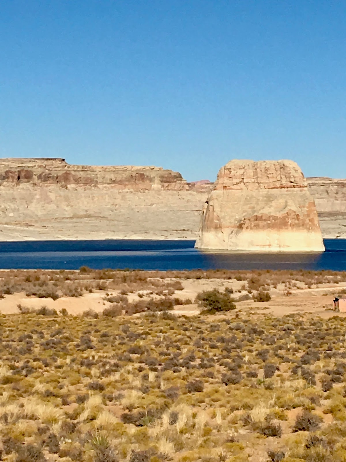
The haze in the distance is from the multiple fires in Utah.
Along Hagerman  Pass


We had lunch at the Mexican food truck that parks in the Safeway plaza. Very good.
I drove around the area where we are, later in the day, looking for future camping sites. Came across this great one located right on a small creek. 39.25045 -106.37637. If I simply didn't feel like packing up and moving, I would have. Next time.
8pm. Frige 33/13.

Friday
The refrigerator experiment. At 6:30am it was out. Ref temps 41/14. Outside temp 38*. I tried starting it but no luck. As the morning progressed, it warmed up and I would try again. Finally when the temp reached 46* the ref started and stayed operating.
Woke up to a bright, sunny day.
Took a ride along the Halfmoon Creek Road towards the Mount Massive Trailhead then continued on a narrow, rough and rocky road that ran along the creek. Saw some great tent camping sites. There are RV suitable sites along Halfmoon Creek Road until the trailhead parking areas then the road becomes too narrow and rough.


Saturday
We drove some of the road to Mosquito Pass.

On old mine

Mine tailings


From Mosquito Pass


Checked out the town dump/water fill station to use on our way out of town. $7.50 for both. Later on, we explored the forest area around where we are camped. There are countless camping opportunities on a network of FS roads. Most are best for tents, but a few can accommodate mid-sized RV's.
We decided to head south on Monday to the Clear Creek Reservoir area.

Sunday
Up at 5am. Had breakfast and dumped the tanks at the city waste water office then headed south to the Clear Creek SWA. People were pulling out. I kept looking and finally found one of the best sites in there. Right on Clear Creek. 39.019514 -106.276265.
In hindsite, the creekside location was a mixed blessing. Carol thought the rushing water was so relaxing and it was. However, once the sun started setting, the mosquitos swarmed like we had rarely ever seem happen. Sitting outside was out of the question.
From our campsite

From our campsite
Morning coffee

 The creek is running high and fast from the snow melt. We're a thousand feet lower here than in Leadville. 8,961'. It's warmer but easier to breathe. We think the elevation at Leadville might have been bothering us in some way. After a nap, we both felt a lot better. We'll hang around here for a few days. Our reservations at O'Haver Lake don't start until Sunday, July 2. We got real lucky the other day and snagged a four day cancelation over the holiday weekend.

Monday
We drove to the Vicksburg and Winfield ghost towns. Both are from the silver mining days. They have a few original structures and several reconstructed ones. There is a camping area at Winfield. There were two RV's there but no way I would drive the camper over 12 miles of rough washboard to get  there.


One of the Aude children


A beautiful drive through the mountains.

Sunday/Monday
Went exploring looking for future disbursed camping sites in the area. Found a real nice one just south of the Twin Lakes  Reservoir.

Tuesday
The mosquitos won. We headed south to Buena Vista. Had a superior lunch at the House Rock Kitchen.
House Rock Kitchen

This has to be one of the very last operating drive-in movies in America.


We drove to the top of Cottonwood Pass. It's closed on the west side for extensive road work.

There were two vans with Texas tags parked near us. One guy in his early 20's perhaps,  was almost unconscious and a girl in her teens, was trying to give him some water. The guys eyes were rolling back. I told the girl that this guy was suffering big time from altitude sickness. The only fix for altitude sickness is to go lower. NOW!!!. She sent a friend to tell the supervisor what  was happening. I explained the problem to two other kids who were rushing back from their hike. Eventually there were 15 or 20 kids loading into the vans. No idea how this poor guy fared.
Once again. Smoke from the UT fires


Deciding what to do  from here. Our reservations at O'Haver Lake don't begin until Sunday.
Probably just go exploring here and there. Plus, of course, some fine meals to give the cook a break.👏👏👏