Tuesday, June 26, 2012

Quartzville Recreation Corridor & Back Country Byway

Monday and Tuesday
We left our nice boondocking spot west of Sisters about 9am heading towards the Quartzville Recreation Corridor and Back Country Byway. The east entry point is at the intersection of OR 22 and Straight Creek Road (FS 11).

Quartzville Rec. Corridor

The road, which is all paved, and well maintained, starts out as a narrow two lane road for a few miles, then changes to one lane with frequent turnouts for the majority of the drive, then changes back to two lanes past the Rocky Top Bridge.  There are no guardrails but if you're starting at this end, you're on the inside and not the cliff-side. It's a long way down from the road to the bottom.
There are a lot of rocky slopes along the road and, in places, the road is narrowed to one lane by small rock slides.  Some of the rocks which had tumbled across the road, but not over the cliff, were big enough that you sure wouldn't want to get hit by one.
A small rock slide over the road

 There were beautiful trees.
 And lots of wildflowers
 And waterfalls
Little waterfalls were everywhere


Disbursed camping rules vary a little depending whether your in the Willamette Forest on in the BLM administered portion of the Corridor. We found this great boondocking spot just across the "new" bridge from the Bridge #6 area. We're right on Quartzville Creek which is a National Wild and Scenic River.   44.57629  -122.30109

 Our campsite
 "old" Bridge #6

In 1969 there was a great flood in this area. "To observe the power of this flood, stop at Bridge #6 where you can still see the remains of the original concrete bridge. Imagine the water level and force needed to toss the old bridge aside."
 Quartzville Creek behind our campsite. The water is crystal clear. And colder then a well diggers arse, as they say.
 The "old" Bridge #6 in the background.
Recreational gold mining is a major attraction in this area. But not here!! Do you suppose they still shoot claim jumpers?


I Identified one more tree today, and learned more about another. The new one is the Red Alder. Learned something new.   The Western Redcedar isn't a true cedar, rather it's a false cedar. The word Redcedar is not separated into two words in order to let readers know this fact. If a Redcedar was a real cedar, it would be spelled Red Cedar.
Some Northwest Indians called the Redcedar "shabalup" meaning "dry underneath". The dense, frondlike branches shed rain much like an umbrella. This morning, when I let Gopher out first thing, it was raining. Again. Once more.  I stood under a nearby Redcedar and was perfectly dry. In fact, about two feet out from the trunk it was very dry, in spite of the all night heavy rain. The Indians were right.
The weather for most of Monday day wasn't too bad. Overcast but no measurable rain. The serious rain started in the evening and continued well into today. The last time we've seen sunshine was last Thursday, the 21st. The solar panels and batteries are really struggling to keep up. So far, I haven't had to use the generator, but nor have the batteries been able to fully charge.

 Free firewood. As long as you have a really big axe.


There is one "regular" campground in the area, administered by the BLM, called Yellowbottom. We took a look and can't imagine why anyone would actually want to pay money to stay there.  All along the road there are a limitless number of great boondocking spots right along the creek. If you were driving a 4WD vehicle, like the Siberian Tiger for instance, there are dozens of dirt FS roads to explore.  West of about the Rocky Top Bridge, where the creek ends and the Green Peter Reservoir starts, are lots of spots for the fisherman and boaters. Some people were camped on the shore with their boat parked right next to their campsite.
As an aside, there is no cell phone service in this area.

Some people camp in tents. This guy keeps his RV in a tent. At least most of it.


The weather was really gloomy this morning, Tuesday, so we decided to continue on in search of the sun. The rain forests are nice, in their own special way, but they are so dark, damp and gloomy. A few days is about enough for us.

Came across this piece of OR history on US 20.

This afternoon we are in the Santium Flat USFS campground on the Detroit Lake.  $7 for old folks. We were here during our '08 trip and remembered it for it's nice, opened sites right where the Santium River ends and the Detroit Lake begins. There is no privacy between sites, and there is some road noise during the day, but we need some sun.  Not today but hopefully tomorrow.

Sunday, June 24, 2012

Summer is here

Thursday:
Summer officially began on the 20th; the summer solstice. Practically speaking, it began the day local schools were out.
This morning, three pickups pulled into the campground. From the looks of their huge tents, and all the other stuff they had,  they are the advanced team for an even larger group.
We headed on this morning knowing that if we were to get a good spot for the weekend, we needed to arrive on Thursday. We drove through the Quinn River and Rock Creek USFS campgrounds but were not especially impressed. Our problem is that we have become terribly spoiled. If a campground doesn't get an 8 on our scale, we continue on.
There are a limitless number of disbursed camping opportunities in the area. I tried two dirt roads that clearly lead down to the river but they just kept getting narrower and more deeply rutted so I found a turn-around.
Here is our next RV:

Our next RV

No need to turn back with this one.

We went to the dump/water fill near the Gull Point campground. This was out motivation for leaving Little Cultus Lake; we were about out of water.  Then we went to the North Twin Lake USFS campground.  We had driven through here before and were very impressed.  It's a small campground with a decent level of privacy between sites. All three of the direct waterfront sites were taken but we got a nice, fairly level, pull-through site with a limited water view.  Two of the three waterfront sites had tags indicating they were leaving in the morning.  We need to go into Bend to resupply before we head out of this area so we decided to stay here, take a site and see what happened with the other sites in the morning.


The day use area is very popular on these warm, sunny days. It has a nice, large sandy beach. A women I was talking to said the crowd of kids are from nearby La Pine. I was sitting outside just watching the world go by when this pickup truck pulled in and disgorged nine kids, four dogs and a pile of inflated water toys. :-)


Friday:

I was up early watching the two sites we hoped to get. Sure enough, about 8am the motorhome in Site #9, the best site in the campground, packed up and left. Thirty seconds later, we were in the site. (43.731448  -121.765030) We have an unobstructed view of the lake. It's a small lake, probably not much more then a 1/2 mile diameter. Gopher and I set out to walk around the lake but the weather started looking nasty so we turned back. We did see an eagle fly off it's nest.  Before we leave, we'll finish the walk.
The lake does not allow power boats; another plus from our point of view. Todays forecast calls for mostly rain. In fact, the forecast for the next several days is for cloudy and cool with a good chance of rain. The last few days were just weather perfect. We've got no complaint coming.

 Our site #9
 Our view

An osprey fishing


The rain pretty much lasted all day. For us it wasn't all that bad but not much fun for the tenters.  A group of scouts pulled in this afternoon and had to do all their setup during a pretty heavy rain.
About 7pm the rain stopped. Within a half hour, there were six guys fishing on the lake. I think they were stir crazy from being cooped up all day.

Saturday:
 
The weather improved some. The rain is mostly an occasional drizzle and now and then, the sun comes out.  Right now it's 1pm and 50* which I suspect will be todays high temp. Gopher and I walked around the lake in the morning. On the far side of the lake, there is a clearing that can be accessed by a Forest Service road. When we're here in the Siberian Tiger :-), that's where we will camp.
From the other side of the lake.

Sunday:

The rain has changed into a heavy mist. By 8am most of the campers were packing up; enough's enough. We were going to stay here another day but decided to head into Bend to run errands before going back into the mountains. We stopped at Wal-Mart, Fred Myers where I got gas for $3.59/gallon, we both got haircuts ($12 each for us old people), did a load of laundry and got Chinese take-out from Safeway, all by about 3pm. Bend has most everything we need but it's a madhouse of traffic.
After errands, we went to Sisters. Sisters is your basic summer tourist trap. Nice enough, but we walked the streets once a number of years ago. That's enough. There is a city RV campground where for only $5, we dumped the tanks and filled up with water.  The RV campground is basically a patch of grass with hookups. Nothing of interest to us.  We have groceries, gas, water and empty tanks. Plus with our new haircuts and clean cloths we both look decent. Life is Good.
We continued west on US 20 to the Deschutes NF about three miles west of Sisters. There are a number of FS roads running off 20. We picked a likely looking one and found a nice boondocking spot for tonight. Near here: 44.31540  -121.57582
Tonights campsite

In the morning we head to the Quartzville Recreation Corridor and Back County Byway.

Quartzville Rec. Area


Tuesday, June 19, 2012

Back in the mountains.

Saturday:
 The fishing tournament got kicked off at 4:23am; one hour before sunrise. :-)
The boats with the conventional outboard engines aren't all that noisy but the jet boats can be.  I think some guys, much like their trucks and motorcycles just like loud toys.
By mid-morning we decided to head into Bend for grocery shopping, laundry and propane then head back to the mountains. Someplace a little quieter perhaps.
We got back on the Cascade Lakes Hwy in Bend. At the higher elevations near Mt. Bachelor, there is still a fair amount of snow on the ground. We stopped next to Sparks Lake. There were people snowshoeing, cross country skiing and hiking in shorts. It was in the low 80*'s; a perfect summer day.


Saturday afternoon is about the worse possible time to look for a campsite. We drove through the very small Point campground on Hosmer Lake, but both of the RV spaces were taken. Elk Lake campground was closed. South campground had some spaces open but none that were very special or even reasonably level. Then we went to Mallard Marsh and got real lucky. We're right on the marsh that surrounds Hosmer Lake. (43.96212 -121.78374) Our view is the marsh, then the lake then the evergreens with Mt. Bachelor in the background. No power boats allowed on the lake so it's very popular with the canoe and kayak people. Catch and release, fly fishing only.

It's very peaceful here, mostly just a bunch of quiet old people like us. Hmmmm.

Mt. Bachelor.


Mt. Bachelor as the storm approaches. It never quite made it to where we were.


I identified a new-to-me tree today. A Western Hemlock. It's a very common tree. According to the book "No tree exceeds this one in pulp quality and yield for high-quality newsprint and book, magazine and tissue papers". You just might be blowing your nose on a dead hemlock tree.

 Sunday:
We continued on to Little Lava Lake, one of our most favorite campgrounds. (43.91019  -121.76319) We came across it on one of our previous trips to Oregon. There is one very special campsite we stayed in the last time but someone was already there. Most of the weekend campers had left, that was the plan, so we were able to get a great site right on the Deschutes River.   Little Lava Lake is the headwaters of the Deschutes River. Gopher and I waded across the river much as we did when we visited the headwaters of the Mississippi River some years back.

Deschutes River


Our campsite

Our view of the river

The beginning of the Deschutes River

Little Lava Lake. Mt. Bachelor in the background.

A male Mallard duck.

.Identified another conifer today. The Englemann Spruce.  Per the book "It's used to make the finest violins in the world".


Monday:
 It rained a little last night and this morning was chilly and grey with a misty rain. We've stayed in this campground before, so decided to go exploring. There are three other FS campgrounds within about ten miles of here. First we drove through the Cow Meadow campground which is located right on the bank of the Deschutes River. It's a small campground having only 18 sites. This would be a great spot for the fly-fisher types. After that we went to the Cultus Lake campground. It's very big with 55 sites, a paved boat ramp and dock. The lake allows boats of all types. This isn't the type of campground we tend to enjoy. We continued on to Little Cultus Lake where we will be for the next several days. (43.80045  -121.86466) Little Cultus Lake allows power boats but with a 10 mph speed limit so that eliminates the jet skies, go-fast boats, jet boats, and such. Plus access is via a three mile long marginally maintained gravel road so that will really keep the crowds away. There are 31 sites here. Tonight it's us and one guy in  a tent. Our kind of place.
We're is a very large pull-through site, #4, completely surrounded by trees and directly on the lake. We have our own little beach area. From our site we can't see another campsite. This campground is easily in our top five all-time favorite campsites. Maybe even the number one formal campground. Our boondocking site on Lake Superior in the Michigan, U.P. remains our favorite overall campsite.


Out campsite

Our view
The weather guessers are predicting close to freezing temperatures tonight with a 30% chance of precipitation in the form of a "winter mix".

Saw three new-to-us birds today. A Red-Brested Sapsucker, a Yellow-Rumped Warbler and a Dark-eyed Junco.

Tuesday:
No "winter mix" but a slight drizzle last night.  Helps keep the dust down.
There are a lot of old downed trees in the area so I collected a good supply of firewood. It never got much above 50* today so the fire felt real nice.
As I type this, Gopher is looking out the screened door at the chipmunks eating the oatmeal I put out earlier. I can just imagine what she's thinking. "Wonder what they taste like? Chicken?"

Keeping warm.


Little Cultus Lake

I found this piece of wood for our fire. It had a bowl shaped cavity in it. As the piece heated up, pitch pooled in the cavity and eventually caught fire. The orange pool of sap is at the left hand side of the "bowl". That's what's burning.
Yet another perfect day.

Saturday, June 16, 2012

Davis Lake and Wickiup Reservoir

Tuesday:

We filled up with water at the Spring Campground.  None of the water faucets are threaded plus the handles are spring loaded to return to the closed position so it's a bit of a pain. I have a water thief and had to use it to connect to the faucet.  Then we went to dump the tanks at the RV campground that is at the corner of Hwy 58 and the access road to the Crescent Lake area. $10. As it turns out, the same $10 also includes water. I'll know the next time.
I went into Odell's bait, grocery, lunch counter, propane, etc. store, to see what they might have we could use to resupply the cupboard. A pack of Oreo cookies was $8, a jar of salsa $6. At those prices, we can live on rice and beans for a few more days.

Came across this interesting bit of history related to the Oregon Trail.


We drove through the Crescent Creek campground but were not impressed. Same with the Lava Flow campground. Tonight we're at the East Davis Lake USFS campground.  $6/night. We have the prime site right on Davis Creek which feeds into Davis Lake.


 Our view. East Davis Lake Campground.


 There is  large marsh adjacent to our site; a source of lots of activity. So far, we've identified the following birds just around the marsh:
Yellow-headed Blackbird, Tri-colored and red-winged blackbirds, Western Tanager, Cinnamon Teal, Malards,  Northern Shoveler, Ring-necked duck, and Townsend's solitair.

 A group of ducks can be called a brace, flush, paddling, raft or team.  We learned years ago after watching them at home, that a group of Painted Buntings is called a palette of buntings.

There was a small, white moth of some type, flying over the marsh. The birds that eat such things were having a field day.

In 2003 there was a forest fire around Davis Lake. It's been almost ten years and grasses are in place, some small animals have returned and  lodgepole pine is growing. Lodgepole pine tends to be the first pine to grow after a fire because it can sprout in very poor soil.
The Davis Lake fire of 2003

For a while, we thought we would have the campground to ourselves again but a couple of fishermen set up a tent a few sites away. Another nice thing about this campground; no mosquitoes.  Both campgrounds we stayed at on Crescent Lake were swarming with mosquitoes as soon as the sun started going down and again until about 10am.


Wednesday:

Continued exploring. We drove through the North Davis Lake campground. There were a few nice spots but they were occupied and very sloped.  From there we went to the Wickiup Reservoir which is only about ten miles from East Davis Lake. There are  eight campgrounds on the reservoir. We drove through North Twin Lake. It was very nice but the few direct lake front sites were taken. South Twin Lake was OK but it's a long way to the lake from the camping area. There is a private resort here as well which is adjacent to the South Twin Lake campground. The small grocery store in the resort had the pancake syrup we needed for "only" $5.75 and a small jar of salsa for $4.50. We drove through the Gull Point campground and found a beautiful lakefront site. $8/night. (43.704090  -121.753547) The lake level is very high. We saw two campsites that were reserved for this weekend that were under water. Boy are those people going to be surprised.  There is a threaded water connection in this campground and a dump station not far away. From the looks of all the reserved sites, the campground will be busy this weekend. It's clear that school's out. Kids everywhere. We don't recall staying in a campground with more dogs per campsite. Big ones, yappy ones, most tied up; some not.  Just your basic family campground; real bedlam.


 Our wonderful view. As long as you only look at the lake.

No privacy at all
The view of our neighbors.

It's shorts weather!!  As best we can recall, this the third shorts day since we left home over two months ago. Gopher and I went wading in the lake.
Oregon Swallowtail Butterfly

The official Oregon State Bug. Not the mosquito like I was thinking.

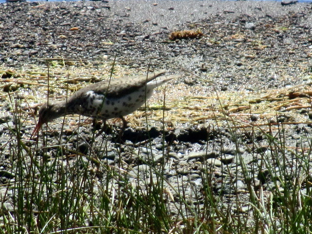
Spotted Sandpiper
I only saw one sandpiper, but if I saw a group of them I'd say I saw a bind, contradiction, fling or a time-step of them. So says the iBird PRO app.
Using the new plant book, I identified Western Fescue and Mountain Brome; two types of grasses.

Thursday:
Another perfect weather day. Our neighbor said there is a big Kokanee salmon fishing tournament on Saturday. Some of the boaters pulled in today. They're easy to spot. Big trucks with a camper on back pulling a $$erious fishing boat. Kokanee salmon, also called silver trout, are landlocked salmon and rarely exceed 14" in length.
Overall, this is a very nice campground for some people. The easy lake access, triple boat ramp,  the convenience of the small store in the resort, the proximity to Bend and the dump station are real assets.  The lake allows watercraft of all type including jet skies, go-fast boats, etc.
We won't be back because big, crowded and noisy doesn't appeal to us, but it would be a super family or boaters campground. Plus, almost no mosquitoes.

Friday:
A lazy day.
Per the campground hostess,  under normal lake conditions, there is a nice beach area for the campers to use. The uncommonly high water level has submerged the beach. The patch of sand between us and the lake is the only sandy area left. Today, two families with their six kids, spent the day at "our" little patch of sand. The children were having a wonderful time playing in the water. At the end of the day we told them rather then hauling all their stuff back to their campers, they were welcomed to just leave it here, so they did. Tomorrow will be another noisy day I'm sure. We really don't mind at all.  There will be time enough for quiet soon enough.


Monday, June 11, 2012

Crescent Lake area

Sunday: A wonderfully bright and sunny day. Long overdue.
Today was exploring day. There are seven campgrounds in the Crescent Lake area. Three are group campgrounds and one is a horse campground. We've been staying in the campground called Crescent Lake. It's the most developed of the group and most convenient to the highway. As a result, it gets the highest amount of use. Today we drove to Spring and Contorta Flat to see what they were like. Spring was much like Crescent Lake but did have some sites right on the lake without having the high bank like Crescent Lake, making lake access much easier.  The paved road ends at Spring. If you keep going for perhaps 3 or 4 miles on a not-too-bad gravel road, you get to the entry road to the Contorta Flat campground.  (The trees in the campground are primarily Lodgepole Pine (Pinus contorta), hence the campground name.) As soon as you turn on the actual road that takes you to the campground, the two lane gravel turns into a very narrow dirt road. The road is wide enough so you won't get the sides of the camper scratched up. The likelihood of someone coming the other way on this road is quite small. Between the gravel road and the lack of potable water,  this campground gets very little use. Tonight it's just us. We're camped directly on the lake with an unobstructed view of Diamond Peak; things just don't get much better then this. We're right here: 43.46178  -122.00742.  If you're willing to take the gravel roads, this is the reward.

 From our campsite
 Keeping warm by the campfire. The trees are primarily lodgepole pine. The tree cover at the Crescent Lake campground was so dense, primarily Douglass-fir,  that the solar panels approached useless. In that respect, this stand of lodgepole is much better.
 A good day for a game of stick.

Diamond Peak

The roving campground host stopped by earlier and seemed surprised to see us. I think his job is sort of like the Maytag repairman.


Old age and poor memory. The older I get, the worse my short term memory gets. Going forward, when I identify, with certainty, a plant or animal, I'm going to write it down. That seems to help me remember.
 This is a Golden Chinkapin. The fruit is covered with a light brown, spiny burr that resembles a porcupine. The nut inside is edible but very hard to get to. However, both chipmunks and squirrels know exactly how to get the nuts and avoid the spines.
 Douglas-fir. When the name of a tree is hyphenated, like a Douglas-fir or incense-cedar, that means the tree is not really a fir or a cedar. Strange!! I mean, if the botanists know full well a Douglas-fir isn't really a fir, why call it a fir? Why not call it what it really is? Or simply admit they don't know?
Ponderosa Pine. This is really a pine tree. No disagreement there.

Saw a Gray Jay, several pairs of Mountain Bluebirds, and watched a Bald Eagle fishing.

 Sunset over Diamond Peak
 
 Monday:
The  second sunny day in a row. We have a streak going!! It's still just us in the campground much to Gophers delight I'm sure. She gets to roam around as she pleases.  We went walking earlier and came across a seep that forms a small stream that leads to the lake.


Tomorrow we continue on by following the Cascades Lakes Highway.