Friday, August 21, 2015

Red Feather Lakes. Dispersed Camping

In the Canyon Lakes Ranger District of the Roosevelt National Forest.

Lost Lakes. 40.84580. -105.52234


Prairie Divide Road Disbursed.
A nice open meadow near a willow lined creek. Prime moose territory. Not too far from a paved road.


40.82903. -105.56413


Monday, July 27, 2015

Odds and Ends from a recent trip

I'm not doing a blog post much anymore. Our first blog started in 2004. I'm about blogged out.
I will, on occasion, provide some disbursed camping information that might be useful to others.

Here are a few from our recent trip to the Frisco, Grand Lake areas.

Just west of the Idaho Springs area off I-70 is Exit 236, Dumont.  On the east side of 70 is a large dirt area frequently used by rafting companies as a launch point. Lots of room to park with some shade from the trees.
39.763420  -105.600239
 Adjacent to Clear Creek.

Just south of the summit of Loveland Pass is Pass Lake. 39.655222  -105.878266
There is a paved parking area, some picnic tables and a few fire rings.  The elevation is 11,821'.
Gopher and I hiked up a nearby slope huffing and puffing all the way. We probably wound up at about 12,000'.  If you hike to the south of Pass Lake, there are two other beautiful alpine lakes. A great place to spend a night. Even have cell phone service.

Had the place to ourselves early in the morning. During the day there is a lot of day use traffic. Best to get your site staked out either quite early or at night.
The wildflowers were everywhere.


Found our next camper.
Even has a solar panel.

Came across a good jeep type place near Keystone. Montezuma Road (CR 5) goes east towards the old town of Montezuma.
FSR 260 intersects with Montezuma Road. Lots of disbursed camping for the jeep/ATV crowd.
39.592050  -105.870965

We stopped by the free city campground in Hot Sulfur Springs. Don't bother. A trash heap.

All around Lake Granby is the Arapho National Recreation Area. There is a great selection of NF campgrounds with the best being Sunset Point. No reservations so you need to arrive early in the week.  40.148543  -105.876402
Put out our hummingbird feeder. Business was good.

Back home planning our next trip to the Snowy Range in Wyoming. We were there in  2005.
On the upper right side of this blog page is a picture of Carol with the three dogs taken in the Snowy Range.

Wednesday, June 24, 2015

Mineral Creek

Monday, June 22

This morning we headed south on CO 550, the Million Dollar Highway. A beautiful drive. Some articles I read talked about it being a hazardous road. I didn't find it like that at all. Both lanes were wide even in places with no road shoulder.  The most tense drives I can recall, are some of the steep and narrow roads accessing the Blue Ridge Parkway in North Carolina. They were build to accommodate two passing 1940's vintage cars and not motorhomes, large trucks, etc. plus some of the grades are over 10%.

I was always hoping I would not encounter a large truck on the road. The truckers didn't even slow down or make an attempt to pull over a little. 

Right now we are at the Anvil disbursed camping area. Right on the South Fork of Mineral  Creek. 
37.82117. -107.71959
Got real lucky on this site. We pulled into the area hoping  for a nice riverfront site. A women with a group traveling in a big 5th wheel waved us over and said they were packing to leave. We pulled off the road and waited. Got a really nice site.
Mineral Creek


Right now its us, a big fifth wheel with a couple and their two grandchildren from Oklahoma. We can just see them through the pines and a motorhome  parked across the creek. Very quiet.
Put the hummingbird feeder out. Attracted a few. Maybe more tomorrow.

Tuesday, June 23.

A nice couple from New Mexico pulled in this morning. They are looking for a campsite for their 5th wheel from this coming Friday through the July 4th holiday. They were thinking that it they got here this early in the week, they would have their choice of prime sites. They came up here last month on a scouting mission when most of the small roads were still snow covered. Their top two sites were already taken. 
This place is much like Owl Creek Pass where we just came from. People from NM and southern CO go to the mountains to escape the heat. Plus, the 4th of July weekend is approaching. Today alone, three campers pulled in, set up their equipment then left. 
They asked if we would mind if they parked the 5th wheel across from our site and park their truck on part of our site so as to stake their claim to the last really good waterfront site. Certainly. We told them we would be leaving here on Thursday and would spread their lawn chairs around to further solidify their claim. 
Now they are both going to see if their boss will let them take Thursday off. 😃

This is just the way it is camping in the CO mountains in summer. Easy during the week, packed on weekends.

Like Owl Creek Pass, for us this would be a Monday through Thursday sort of place. The weekends have to be a madhouse. 
I'm guessing that if you don't have your camping area established by about tomorrow, there will be nothing left for the 4th of July holiday.
We plan to be home by about July 1 so we won't have to deal with that.
Not much hummingbird action today. Two or three, that's about it.

Wednesday, June 24
  
Gopher and I took a nice walk up to a marshy area. Perfect for a moose but we didn't see any. Just a deer and a squirrel. 

The high iron content in the rock colors the water in the ponds.

People continue to drive through the area looking for a good spot for the upcoming holiday week. Not much left here.

In the morning we continue south towards Durango.

Sunday, June 21, 2015

Owl Creek Pass area. True Grit.


Friday,June 19
Up early again. On the road by 6:30. We stopped at the bakery for a loaf of fresh bread and a warm cinnamon bun, then to the Montrose Fairgrounds to use the dump station and to top off with water. Today's destination is the Silver Jack Reservoir/Owl Creek Pass area. We accessed this FS area from the north off US 50 using the Big Cimarron Road which, eventually, becomes FR 858 in the Uncompahgre NF. The road is well maintained dirt and gravel. Perhaps 20  miles or so, from US 50 to where we are now. Drove through the two campgrounds (Beaver Lake and Silver Jack) just to look. Both are nice but nothing special. We were looking for disbursed camping. Drove some different FS roads until we stumbled onto 858.3G per the MVUM of the area. We're here: 38.20560. -107.52191. We're at 9,000' About 100' from the Uncompahgre River in a small meadow of grass and dandelions surrounded by pine  and aspen. Good sun for the solar panels. We drove all of the roads that were along the river. There are a dozen, or more, great riverfront disbursed sites and they are all taken by big trailers. I guess we're lucky to have snagged this one. 
Our campsite
The river across from our campsite
A good day for a swim

Company with the morning coffee.

We're staying here until the weekend crowd clears out on Sunday.  According to a guy I was talking too, this is pretty much a Montrose locals place. Some bring their ATV's some their dirt bikes. It's only about an hour from town.
Cooked salmon and sweet potatoes on the grill then had a campfire from wood I found along the river.  

Saturday, June 20
This place gets crowded on Saturday. Between the convenience to Montrose, the 100* temps, the river and assorted ATV and jeep trails, it's really busy. Should we come back again, and we certainly would, we would make it a Monday-Thursday trip. But, even on Saturday, by about five, everyone was back at their campsite and the day users were gone. The evenings were peaceful and quiet.
Spoke to two locals about the road south towards Ridgeway. While neither had driven it this year, they both recommended against it. In the past there have been wash-outs, huge potholes (one guy said the potholes would stop a tank!), etc. plus we needed to dump our tanks, top off with water, go grocery shopping, etc., so we decided to head back the way we came and spend the day in Montrose. 

Sunday, June 21, the Summer Solstice.
In the morning, we drove the six miles up to the Owl Creek Pass. Got a picture of Chimney Rock but couldn't find the grassy meadow (Deb's Meadow it's called) where Rooster Cogburn made his famous charge against the four bad guys. "Rooster Cogburn sits astride his horse, rifle in hand, reins between his teeth and draws his pistol." Anyone who has seen the movie remembers the rest.  In 1969 John Wayne won his only Academy Award for Best Actor for his Rooster Cogburn role. I remember Rooster shooting that six gun probably fifty times without reloading. 😉
Chimney Rock
Beaver lake near the pass

Then off to Montrose to take care of business. 
Right now we're in the Amphitheater Campground in Ouray.  Still too warm for us. In the morning we head higher.
Had a nice conversation with a guy very familiar with this part of CO. Got some good travel ideas.

Thursday, June 18, 2015

Delta and Montrose. Hot, hot, hot.


AWednesday, June 17
Carbondale is a nice place to spend a day. Just across the street from where we are parked is the City Hall and Recreation Center; both of which have a free wi-fi connection. If someone needed it, the Rec. Center has shower facilities. 
Gopher and I  took an early morning walk around the old downtown area. Modest homes, but well maintained, nice gardens, some interesting sculptures, etc.  
We headed north on CO 133. Right now we're in the Bogan Flats FS campground on the Crystal River. Since the FS started using concessionaires, the cost of camping has gone up. Here it's $22/night plus $5 more if you have a second vehicle like a tow car. We pay half with our Golden Age Passport so it's $11/night for us. 

From our site. Crystal Creek

We put the hummingbird feeder out. So far we have identified the Black-chinned and Broad-tailed Hummingbirds.
 

I started a new book the other day. The  Fateful  Lightning  by Jeff Shaara. It's the fourth, and final, in his series on the Civil War. Over the years,  I think I have read every book written by Jeff or his father, who's name eludes me now. They have written about the American Revolution, the Civil War and about both WW-1 and 2.  They are novels, but the main characters, like General Sherman, in this story, are real. Like James Mitchner,  the stories are very well researched and based on historical facts.

Had a little campfire tonight and toasted marshmallows.
Gopher likes hers uncooked.

Every site here is reserved for this coming weekend. 

Thursday, June 18.
Drove to Delta with the idea of spending a day, or so, exploring the area. We started at the dump station behind the visitors center. I had hoped to get water but the water at the station was signed as not potable. There was a city employee topping off a water fountain nearby. I asked if he knew where I could get some fresh water, hoping he might say, "sure, help yourself". He did. I used his water hose to top off the tank. 
The local Forest Service office had a wealth of good information. I got the maps for the Ridgeway, Ouray and Telluride areas. 
Then we had lunch at the Brick Wall restaurant nearby. A very good choice. We started on a drive suggested in the Fielder book were using. The area around here is high desert; not real interesting to us so after perhaps, ten miles, we turned back. It was over a 100* around here today. We gave up on Delta and started heading towards the mountains again. Tonight we're in Montrose. The bank temp. sign read 103*.  Right now it's 9:20 and its 81* outside.
 There is a  city park in Montrose that allows free overnight RV parking.   It's the West Main Trailhead Park on CO 90. 38.47486. -107.88461. 
In the morning, we head to the mountains. The Fielder book talks about the Owl Creek Pass near Ridgeway. At just over 11,000' that should be nice and cool. The best movie ever made, True Grit,  was filmed around the pass. If it's good with The Duke, it's good with us. 
http://co-montrosevcb.civicplus.com/143/Owl-Creek-Pass-and-Silver-Jack-Reservoir

Tuesday, June 16, 2015

Longmont to Carbondale, CO


Sunday, June 14

Jennifer and Karen left early in the morning after their nice visit.
We left home a few minutes before 9am and drove to the Heaton Bay campground near Frisco.  Stopped in Idaho Springs for a rest. There is a really nice creek side park near the Visitors Center with easy RV parking. Clear Creek is running high and fast. There were dozens of people loading up for raft rides. Idaho Springs is very convenient to Denver so I suspect that's where the crowds were from. There have been three recent drownings from capsized rafts but that doesn't seem to concern people.  As turbulent as the water is, I'm sure you get an exciting ride.
We got a decent site at Heaton Bay; certainly adequate for one night. The place was a lot more crowded then when we were here just two weeks ago.

Monday, June 16
I was up, had a cup of coffee, and out walking with Gopher by 6am. It just gets so light, so early. The first day of summer is later this week, so the days are very long. We were finished with breakfast by 7:30. Stopped by the new Whole Foods in Frisco. Split a very good breakfast sandwich, bought a loaf of just-out-of-the-oven cranberry walnut bread and some chocolate chip cookies.  Then a quick stop at WalMart for a hummingbird feeder.
Then we took SR 91 to Leadville. Stopped at the Forest Service Office to add  to my MVUM  collection. 
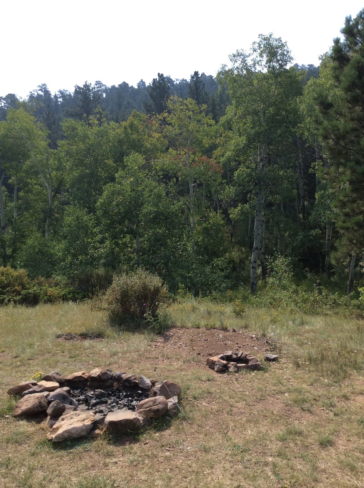
 The Fielder book we're using as a travel guide, of sorts, lead us to FR 110(Halfmoon Creek Road). A beautiful drive towards Mount Elbert(at 14,433' the highest mountain in CO.) and Mount Massive(14,421').  We came across a number of very nice disbursed camping areas all along the road.  A good  place to stop if visiting the  Leadville area. The women in the FS office was very helpful with camping ideas and tried to tell me about a bunch more nice places near Leadville,  but my hearing has gotten so bad, I just could not understand what she was saying. She was nice enough to mark you-are-here on map she gave me. 
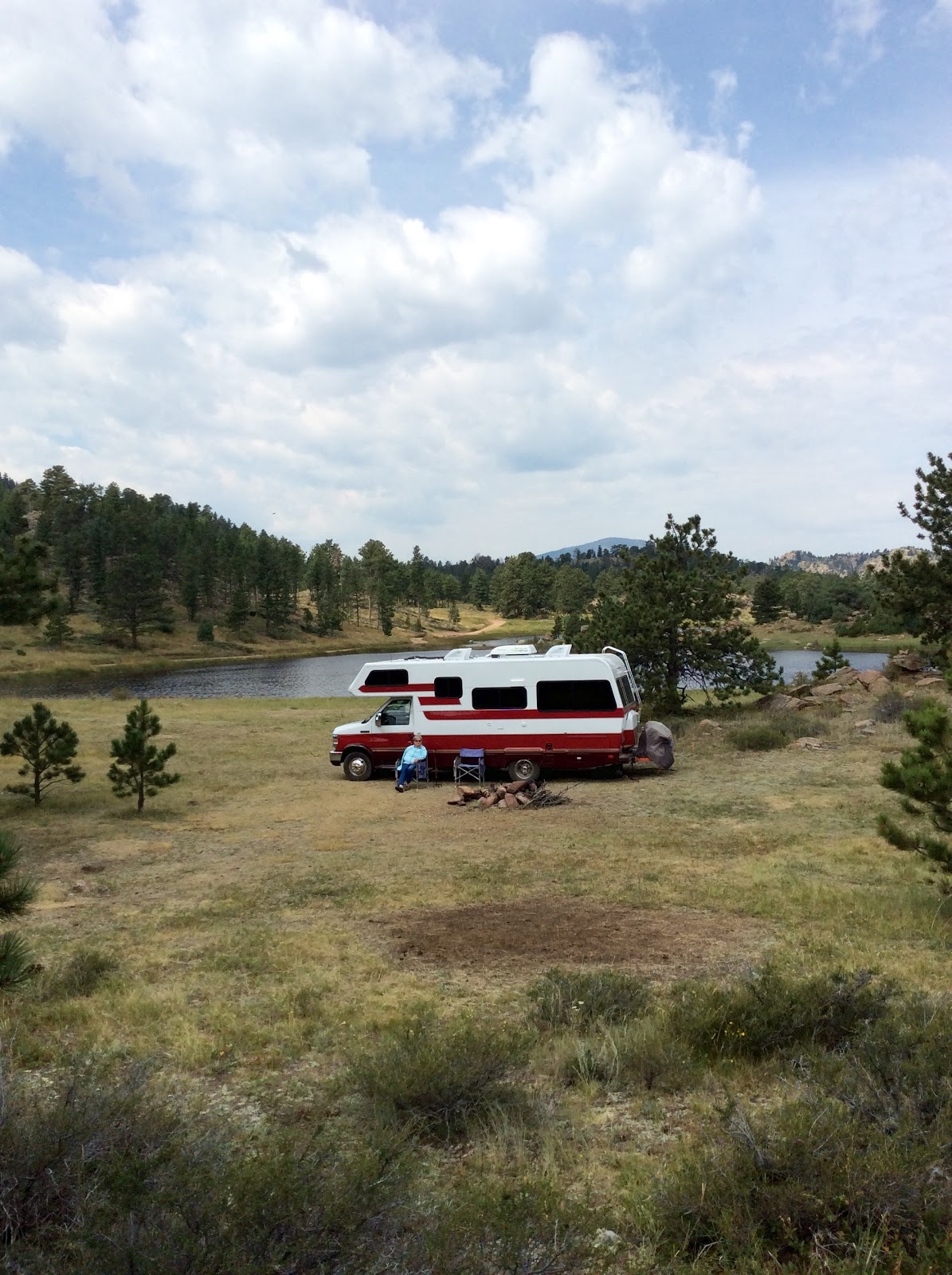
We continued south to the Clear Lake Reservoir SWA intending to stay the night. We had been there before and it's a  very nice free camping area right on a stream. Popular with the fishermen types.


 By about 2pm we decided to head off to someplace we had not been before so started on CO 82 (Independence  Pass Road)towards Aspen. There is a limit of 35' total length for vehicles on this road. Tight switchbacks near the top. 
The road follows the Roaring Fork River. We kept looking for a place to camp for the night and came across this. It's not too far west of FR 391. We tried to drive 391 but it got so rocky and narrow, I turned around as soon as I could.  Good luck, as it turns out. Where we are is probably  one of the most beautiful campsites ever. We are right on the rivers edge. Just us. 39.08945. -106.54176.  Just across the creek is the remains of a log cabin. Wonder if this was someone's homestead in the 1800's? Gopher had a nice swim in the river with her leash on. The current is quite strong.

Our campsite
The Roaring Fork River
A good day for a swim.


Then we had salads for dinner to help offset the Cranberry bread and the cookies. On the average, we do OK.
Tomorrow we drive Independence Pass; at 12,095' it's the highest paved pass in North America.
 
Tuesday, June 17.
Up again by six. On the road by 7:30. The drive over Independence Pass in interesting in a, relatively speaking, wide RV. In places on the Aspen side of the Pass Road, the road narrows to 1 1/2 lanes. Twice I stopped, moved as close towards the cliff as possible then pulled in the side mirror. 
It's still winter at the top of the pass. Rainy, foggy, windy and cold. Gopher and I took a real quick walk.

 
It's still winter at 12,000'

We drove to Aspen but it turned out to be a madhouse of congestion and traffic so we continued on to Carbondale.  Carbondale has a nice city parking area right downtown at the corner of 4th Street and Colorado Ave just across from the City Hall and Police Station. You can stay overnight there. We had a very good lunch at the Village Smithy Restaurant.   Then got Gopher and walked around downtown and on the multi- use trail. Tomorrow is the weekly green market.
The Forest Service office was staffed by a really helpful guy. Got more MVUM maps plus he directed us to a nice campground for tomorrow.

Monday, June 08, 2015

Steamboat Springs


Friday, June 5
When we got up, this morning, we had the entire camping area to ourselves. A deputy sheriff pulled in last night. I thought he was going to say we couldn't camp there but he just waved and continued on. 
We spent all day in Steamboat Springs.  
For breakfast we went to the Creekside Cafe and Grill. This is probably the best breakfast restaurant we have been to since our trip to New Brunswick, CA years ago when we had breakfast at Cora's in St. John. Carol had the special which was French toast, filled with chocolate and topped with strawberries. I had  real corn beef hash, with two eggs and a homemade biscuit. What a breakfast!  Feeling slightly guilty, and very full, we skipped lunch and had a salad for dinner. Everything averaged out. 
The weather prediction for today was for strong thunder storms. Yesterday, in Longmont, they had a serious storm including a tornado touchdown, lots of lightning and hail. Fortunately, for us, the tornado was a few miles away. Around our house we just got the 4 to 6 inches of rain.  Not wanting to be camping in a high exposed area on dirt roads if a storm like that came through, we  opted for the only commercial campground in Steamboat; a KOA. $51 for the most basic site they had. Commercial campgrounds are nice, now and then. We got rid of three bags of trash, dumped the tanks, filled up with water and took long, hot showers. 
Stopped by the FS office to pick up the MVUM for the Routt NF. Over time, I want to collect the map for all of the CO NF's.  These maps are the best way to find legal disbursed camping areas. 
In the afternoon, we parked by the river and took a nice long walk. The Yampa River is running high and fast like the Eagle and Colorado. 
The weather turned out just fine. A few light showers but that's about all. 

Saturday, June 6

We went for one more  breakfast at the Creekside Cafe. Carol had the special; apple pancakes with cream cheese topping. I had the juevos rancheros with home-made sausage. Like most restaurants in ski towns, they charge ski town prices. Breakfast with coffee runs about $30 for the two of us. 
On our way out of town we stopped at the Howelsen Ski Area off 5th Street to take Gopher for a walk. At the far end (west?) of the parking area was an RV that had clearly stayed the night. There were park employees as well as a sheriffs deputy in the parking area, none of which seemed concerned with the RV. This might be a nice overnight spot for future use.
The weather forecast for Saturday was dreary so we decided to get some of the drive home behind us. We followed SR 14, the Poudre River/Canyon Road.  Pulled into the Kelly Flats campground. Someone had just pulled out of a great riverfront site. Like the other rivers, the Poudre is running high and fast.  We were here two years ago just after a big forest fire. The river bottom was covered with ash from the fire. I remember talking to a ranger who said it would take a season of high water to flush out the river and return the  good fish habitat. 
From our campsite.

Sunday, June 7

Headed home. The Lazy Daze was flawless. Not even a little problem . I guess this is why people are willing to wait for a year or pay a premium for a used rig vs an off-the-lot Winnebago, and such. 

Monday, June 8

Gave the camper a bath, had the oil changed at Walmart, dumped the tanks, installed a grab bar in the bath for Carol and just poked around getting it ready for the next trip. 

Thursday, June 04, 2015

North towards Steamboat Springs


Wednesday, June 3
We left Heaton Bay about 9am. Add this campsite as a good one in Heaton Bay. Site 76.
Picked up a few WalMart items then went to the Buttercup Bakery on the way out of town. Headed west on I-70 and got off at the west Vail exit #171. Stopped at the USFS office and got the Motor Vehicle Use Map for the area. This will be a good source of camping info. going forward. Took US 6 west which follows the Eagle River. The water is very high and fast. We stopped at the BLM  Wolcott Recreation site to watch the rafters taking off. I was talking to the guides and they  said they were booked solid for most of the prime time. Good money for the guides. The guides are commonly called River Rats.  In 2000 we went white water rafting in Alaska.
Rafters on the Eagle River

In Dotsero we headed north on CR 301, the Colorado River Road. The road is probably 1/3 paved with the rest being very good, well compacted dirt. The Union Pacific RR runs right alongside the river. This was very common when the railroads were being built because the river naturally took the low ground thus avoiding tunneling or climbing mountains. Around here, the river runs from northeast to southwest.  The CO River starts as a creek draining the high country in the RMNP.  The river is lined with spruce, fir, ponderosa pine and cottonwoods. We stopped at Lyon's Gulch Rec. Site thinking  about spending the night but it wasn't much so we continued north.   We wound up at the Catamount Bridge BLM site. This is a free BLM camping area and  boat ramp site. We have the place to ourselves tonight. The U.P. tracks are right across the river. So far, there have been four long coal trains rumbling by.  The elevation is 6,600'. The refrigerator is working just fine confirming that the problems we were having at Frisco was the 9,000'+ elevation. We cooked salmon and sweet potatoes on the grill and it worked just fine then had a small campfire from downed wood. 
No cell phone service along the road.
The Colorado River with rafters.
A good part of the road runs through a red rock canyon.

An old gas station sign along the road
 
Our camping neighbor


Thursday, June 4
We continued north on the CO River Road then north on CO 131 to CO 134. Drove the Lynx Pass(CR 16) to the top and then took FR 206 toward the Rock Creek SWA.  There is a two story log building from about 1880 that was a residence, stage stop, hotel, and post office.A few miles down the road, Rock Creek had complete breached the roadway.  Times like this is when the little 24' rig is nice. The short wheelbase can turn around on a one lane road.  The initial plan was to camp off FR 206 but that didn't work out. 

The washed out road.

We headed north towards Steamboat Springs. The campgrounds around Rabbit Ears Pass don't open until June 15 so we found a place to park in the woods. The detailed maps of the NF's have already come in handy. At 9,265'.

On Rabbit Ears Pass.
Still a work in progress learning Blogger with the iPad.